Best Handheld GPS for Hiking 2026: Top Picks for Outdoor Adventures

When you’re out on the trail, having the best handheld GPS for hiking can make all the difference. It’s not just about finding your way, but also about staying safe and confident in unfamiliar terrain. A good handheld GPS is easy to use, reliable, and built to handle the outdoors. Whether you’re a casual day hiker or someone who loves long backcountry trips, the right device keeps your location clear and your route tracked. It’s a simple tool that adds peace of mind and lets you focus on enjoying nature.
Garmin Gpsmap 65 Handheld Gps
For hikers looking for reliable navigation, the Garmin GPSMAP 65 stands out as a top choice in the Best Handheld Gps for Hiking category.

Everyday Hiking Navigation Features
| Display | 2.6” sunlight-readable color screen |
| Satellite Support | Multi-band GNSS for better accuracy in tough terrain |
| Mapping | TopoActive maps with public land data (U.S.) |
| Connectivity | Compatible with Garmin Explore app |
| Size & Weight | Compact and lightweight at 0.48 lbs |
The Garmin GPSMAP 65 is a button-operated handheld GPS designed to help hikers navigate with confidence. It solves the common challenge of losing signal or accuracy in dense forests, steep valleys, or urban canyons by using expanded satellite support and multi-band technology. The bright 2.6-inch color display is easy to read even under bright sunlight, making map details clear on the go.
In real use, this device feels sturdy and reliable. Managing routes and waypoints is straightforward with the Garmin Explore app integration, which adds convenience for tracking progress and reviewing stats. I found it reassuring to have such dependable positioning, especially when exploring unfamiliar terrain.
Who Benefits Most and Who Might Look Elsewhere
This GPS unit fits well for day hikers and backpackers who need precise navigation in challenging environments. Its robust satellite tracking and detailed topo maps support a variety of outdoor adventures. Those who appreciate physical buttons over touchscreen controls will also find it user-friendly.
However, if you prefer a lightweight device with touchscreen features or need international topographic maps beyond the U.S., this might feel limiting. Also, those who want built-in smartphone-style apps may want to explore other options.
- Ideal for rugged terrain navigation
- Good for users valuing button controls
- Best for U.S.-based hiking due to mapping
- Less suited for touchscreen enthusiasts
- Not the lightest option available
Thoughts on Practical Use
This GPS unit is a solid choice for hikers who prioritize reliability and accuracy over flashy features. It is easy to read and operate, with a well-balanced size and weight that won’t slow you down. The trade-off is its lack of touchscreen and limited map coverage outside the U.S., but it delivers dependable navigation where it matters most.
Consider This Before You Buy
If you regularly hike in dense or challenging landscapes in the U.S., the Garmin GPSMAP 65 can be a trusted companion. It’s best for those who want clear, physical controls and strong satellite reception. On the other hand, if you want a more modern interface or global map coverage, you might want to look at other models.
Remember to pair it with the Garmin Explore app for better route management. This setup can save time and add confidence when you’re out on the trail. The device’s straightforward design means you can focus more on your hike and less on fiddling with settings.
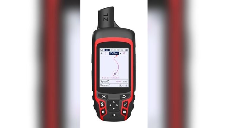
Compact Rugged Hiking Gps
This Best Handheld Gps for Hiking is ideal for outdoor enthusiasts who need a durable and reliable navigation tool on the trail.

Navigation Made Clear and Dependable
This handheld GPS unit is built for hiking, providing a rugged and waterproof design that withstands tough outdoor conditions. It solves the problem of getting lost by offering precise location tracking using multi-GNSS support, which improves accuracy to within six feet—helpful when you need exact positioning on trails.
In use, the bright 3.2-inch sunlight-readable screen and physical buttons make it easy to operate even under bright skies or while wearing gloves. The device feels solid and reliable, giving confidence that you can track your route or return to your starting point without fuss.
Who This Works For and Who Might Pass
This GPS is well suited for hikers who need a compact, durable tool that performs well in various weather thanks to its IP66 water resistance and long battery life. It fits those who value straightforward navigation with a digital compass and barometric altimeter to support off-trail orientation.
If you prefer a touchscreen interface or need advanced mapping software beyond the included USA topo map, this unit might feel limited. Also, those who want a very lightweight device might find it a bit bulkier due to its rugged build.
- Great for precise navigation in bright outdoor environments.
- Physical buttons aid usability in challenging conditions.
- Long battery life supports extended hikes without charging.
- Water-resistant for reliable use in rain or wet terrain.
Considering This GPS for Your Hikes?
If you often hike in remote areas where reliability and ruggedness matter, this GPS will serve you well by providing accurate positioning and durable construction. It’s less suited for casual users who prefer smartphone apps or touchscreens. When you first get it, spend some time learning the button layout to speed up map navigation on the trail.
This device offers steady performance without unnecessary complexity, so you can focus on your hike rather than fiddling with tech. It’s a practical choice for those who want trustworthy navigation support and peace of mind outdoors.
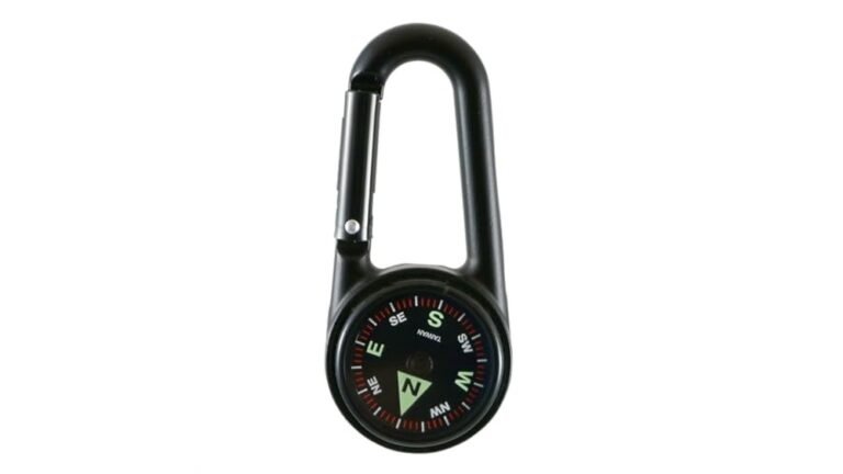
Niesahyan A6 Hiking Gps Navigator
The NiesahYan A6 is a solid choice for those seeking the Best Handheld Gps for Hiking, ideal for hikers who need reliable navigation in tough terrain.

The NiesahYan A6 is a handheld GPS device designed for outdoor enthusiasts who want dependable navigation on their hikes. It solves the problem of losing direction by supporting multiple satellite systems, which improves location accuracy to under 5 feet, even in difficult environments.
Using it feels straightforward thanks to its bright 2.4-inch color screen and physical buttons that work well in all conditions. The battery life of up to 20 hours means you can trust it for extended trips. I found its waypoint and track navigation features especially useful for planning routes and safely returning to my starting point.
Practical Features for Hiking Navigation
- Multi-GNSS support ensures precise positioning in forests or mountains.
- Bright, sunlight-readable display with tactile buttons for easy use.
- Track recording helps guide you back if you lose your way.
- Long battery life reduces worry on longer hikes.
- Waterproof and rugged design for outdoor durability.
A Balanced Look at the Device
This GPS unit works well for those who want clear navigation without complicated interfaces. However, users expecting smartphone-like maps or touchscreen controls might find it limiting. The small screen size is practical but less suited for detailed map viewing. Overall, it is a reliable tool focused on core hiking navigation needs.
Who Benefits Most from This GPS
The NiesahYan A6 fits hikers who prioritize accuracy, durability, and long battery life on their outdoor adventures. It is especially good for those trekking in remote or challenging terrain where phone GPS can falter.
It might not suit users wanting advanced map layers or smartphone-style interfaces. Those who prefer touchscreen controls or need extensive connectivity features should consider other options.
- Great for solo hikers and trail walkers.
- Ideal for multi-day trips needing reliable battery life.
- Less suited for tech-heavy users wanting interactive maps.
- Compact and rugged for tough outdoor conditions.
Clear Navigation for Confident Hiking
If you want a dependable handheld GPS that focuses on solid navigation basics, this device is worth considering. It serves well on long hikes where precision and durability matter most. Those needing complex mapping or smartphone-like features may want to look elsewhere.
Remember to familiarize yourself with its waypoint and track functions before heading out. This will help you use it with confidence and reduce stress during your hike. Overall, it offers peace of mind for outdoor navigation without unnecessary extras.
Garmin Etrex 10 Handheld Gps Navigator
For hikers seeking the Best Handheld Gps for Hiking, this Garmin eTrex 10 provides reliable navigation and rugged design suited to outdoor adventures.

Practical Features for Outdoor Navigation
- Preloaded worldwide basemap helps plan routes without extra downloads.
- Waterproof IPX7 rating protects against rain and splashes during hikes.
- Long battery life of up to 20 hours with two AA batteries keeps you going.
- GLONASS support improves satellite positioning speed and accuracy.
- Compact size fits comfortably in hand or gear pouch without bulk.
Considerations on Usage
- Monochrome display means no color maps but aids in battery longevity.
- Basic interface may lack some advanced features found in newer models.
- Paperless geocaching support is useful but requires some learning curve.
Thoughtful Choice for Steady Navigators
The Garmin eTrex 10 is a straightforward handheld GPS designed for hikers who want reliable, no-nonsense navigation. Its rugged build and waterproof design mean it handles outdoor conditions well without fuss.
While its monochrome screen is simple, it extends battery life and keeps the device lightweight. This model doesn’t have the bells and whistles of newer units but covers essential navigation tasks effectively. It might not suit those craving color maps or touchscreen ease, but it offers dependable guidance for basic hiking needs.
A Balanced Pick for Practical Hikers
If you are a hiker needing a tough, easy-to-use GPS with solid battery life, the Garmin eTrex 10 fits well. It’s especially good for those venturing into varied terrain where waterproofing and global positioning matter.
However, if you prefer a device with a color display or more advanced mapping features, you might find this model limited. A practical tip is to carry spare AA batteries to maintain uninterrupted use on longer trips.
Overall, this GPS provides quiet confidence without overwhelming complexity, making it a steady companion for focused outdoor navigation.
Garmin Etrex 32x Handheld Gps
For hikers who need a reliable and easy-to-use handheld GPS, the Garmin eTrex 32x offers solid navigation features as the Best Handheld Gps for Hiking.

Daily Use Highlights for Hikers
- Sunlight-readable 2.2” color screen keeps maps clear outdoors.
- Supports GPS and GLONASS for better tracking in dense forests or canyons.
- Preloaded topo maps help plan routes and find trails easily.
- Compact and lightweight, it fits comfortably in hand or pack.
- Internal memory plus micro SD slot allows ample map storage.
- Simple interface reduces time spent fiddling with settings.
- Battery life supports long day hikes without frequent charging.
Making Sense of the Garmin eTrex 32x
This device is a straightforward handheld GPS designed to provide dependable navigation on hiking trips. It solves the common problem of losing direction when trails become unclear or when cell signals fail, using both GPS and GLONASS satellites for stronger positioning.
Using it feels intuitive and reassuring. The screen remains visible even under bright sunlight, and the preloaded topo maps make route planning quick. I found it easy to carry and operate, which helped me focus more on the hike and less on navigation.
Who Benefits Most and When to Look Elsewhere
Hikers who want a rugged, no-nonsense GPS with reliable satellite support will appreciate this model. Its lightweight form and clear display suit day hikers and casual backpackers who need trustworthy navigation without extra features.
Those wanting touchscreen controls, smartphone connectivity, or advanced sensors might find this device too basic. If you prefer a GPS with more modern interfaces or additional functionalities, this might feel limited.
- Fits well for outdoor enthusiasts focused on hiking and trail navigation.
- Less suited for tech-savvy users wanting integrated smart features.
- Ideal for those who value battery life and screen visibility outdoors.
- Not recommended if you require a multi-sport or touchscreen GPS.
Choosing the Garmin eTrex 32x for Hiking
This GPS is a solid choice for hikers prioritizing reliability and ease of use over bells and whistles. If you often hike in areas with challenging terrain or dense canopy, the dual satellite support adds peace of mind.
However, if you prefer a device with more interactive features, this might not meet your expectations. A useful tip is to familiarize yourself with the preloaded maps before heading out; it helps speed up navigation on the trail.
Overall, the Garmin eTrex 32x offers dependable performance that can help you stay on course without fuss, making it a practical companion for many hiking adventures.
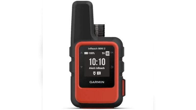
Garmin Inreach Mini 2 Compact Gps
The Garmin inReach Mini 2 is ideal for hikers seeking the Best Handheld Gps for Hiking that offers reliable communication and navigation in remote areas.

The Garmin inReach Mini 2 is a lightweight satellite communicator designed for hikers who need dependable navigation and emergency messaging anywhere in the world. Its TracBack routing feature helps you safely return to your starting point, which is invaluable in unfamiliar terrain.
In use, this compact device feels reassuring and straightforward. Syncing with the Garmin Explore app makes planning easy, while the digital compass provides accurate heading even when standing still. I found it quick to share my location with family, adding peace of mind on long hikes.
Daily Use Highlights and Considerations
- Compact and lightweight for easy carrying without bulk
- Two-way messaging supports communication even off-grid
- Water-resistant design suitable for various weather conditions
- Syncs with smartphone app for trip planning and waypoint management
- Requires active satellite subscription for messaging features
- Limited screen size means less detailed map viewing on the device
Choosing This Device for Your Outdoor Adventures
This device suits hikers who prioritize safety and communication during remote trips. If you often venture where cell coverage is absent, its global satellite messaging is a strong asset. It’s also great for those who want a compact gadget without sacrificing navigation features.
However, those looking for a full-featured GPS with extensive on-device maps might find this too minimal. Also, the need for a satellite subscription may not appeal to casual users or those on a tight budget.
- Best for serious hikers and backcountry explorers
- Ideal when satellite communication is essential
- Less suited for casual day hikers or budget-conscious buyers
Thoughts on Practical Use and Suitability
The inReach Mini 2 offers a balanced mix of safety and simplicity. It keeps you connected when traditional networks fail, which is often the case in wilderness hiking. The trade-off is mainly in screen size and subscription costs, but for many, the peace of mind it brings outweighs these factors.
Its rugged and compact form makes it easy to carry along without weighing you down. The device feels reliable and is straightforward enough for those not wanting to fuss with complicated menus or heavy gadgets.
Consider This Before You Buy
If you regularly hike in remote areas where you might need emergency communication, this Garmin model is worth considering. It blends useful navigation with global satellite messaging in a small package. On the other hand, if you prefer richer map displays or want to avoid ongoing fees, you might want to explore other options.
One tip is to familiarize yourself with the Garmin Explore app before heading out. This can save you time in the field and make trip planning smoother. Overall, this device offers quiet confidence for hikers who want reliable help at their fingertips.
Compact Rugged Handheld Gps
The Best Handheld Gps for Hiking for outdoors enthusiasts needing reliable navigation in tough conditions.

Navigation and Usage Highlights
| Satellite Systems | GPS, Galileo, Beidou, QZSS |
| Screen | 3.2” Sunlight-readable color display |
| Battery Life | Up to 36 hours per charge |
| Waterproof & Rugged | Designed for outdoor durability |
This handheld GPS is designed to provide accurate navigation support for hikers and outdoor adventurers. It solves the common problem of losing direction by offering multi-GNSS support, which improves location precision to within 5 feet, a key feature that stands out from basic GPS units.
Using this device feels straightforward and reassuring. The sunlight-readable screen ensures clear visibility even in bright conditions, and the long battery life means fewer interruptions. I found it easy to set waypoints and follow routes, which helps maintain confidence on unfamiliar trails.
Choosing This GPS for Your Outdoor Needs
This GPS fits well for those who spend extended time hiking or camping and need a reliable, rugged device that won’t fail in harsh environments. Its compact size and waterproof build make it a practical companion for serious outdoor users.
However, casual users who prefer smartphone apps or simpler devices might find the learning curve and features more than they require. The device’s weight and dimensions could be less ideal for those prioritizing ultra-light gear.
- Ideal for multi-day hiking and backcountry navigation
- Great for users needing precise tracking and waypoint management
- Not suited for minimalistic day hikes or basic location checks
Thoughts on Practical Use and Suitability
For hikers venturing into remote or challenging terrain, this GPS offers solid performance with its multi-GNSS satellite access and rugged design. Its battery life supports long outings without frequent recharging, which is a significant plus. The interface is clear but may require some initial familiarization.
One trade-off is the device’s bulk compared to simpler trackers, but that comes with enhanced durability and functionality. Overall, it balances usability with advanced features effectively for serious outdoor use.
When to Consider This GPS and What to Expect
If you often hike in areas with poor cell coverage or demand high navigation accuracy, this device is a dependable choice. It keeps you oriented and tracks your path reliably, even in dense forests or mountainous regions.
Those relying mostly on casual or urban hiking might find it more than necessary and prefer lighter, simpler gadgets. Remember to keep the device charged before heading out, as extended use depends on battery management.
This GPS offers a calm assurance: it’s built to withstand the outdoors while helping you stay on course without fuss.
Garmin Etrex Se Handheld Gps
If you are looking for the Best Handheld Gps for Hiking, the Garmin eTrex SE is a solid choice for hikers wanting reliable navigation and long battery life.

Everyday Hiking Navigation Essentials
- Easy-to-read 2.2” screen visible in bright sunlight
- Exceptional battery life up to 168 hours standard, 1800 hours expedition mode
- Wireless updates and trip planning via Garmin Explore app
- Supports multiple satellite systems for reliable tracking in tough terrain
- Lightweight and compact, fits comfortably in hand
Considerations for Use
- Requires two AA batteries, which are not included
- No touchscreen; navigation is button-based
- Basic interface may take some getting used to for new GPS users
The Garmin eTrex SE is a handheld GPS designed to provide accurate navigation and long-lasting power for hikers venturing off the beaten path. Its sunlight-readable screen and multi-GNSS support help you stay on track even in challenging environments.
Using it feels straightforward once familiar with the controls. The extended battery life means fewer interruptions, allowing more focus on your hike. I found pairing with the Garmin Explore app useful for planning routes and getting weather updates.
Practical Thoughts on Choosing This GPS
This device suits hikers who value battery endurance and reliable satellite tracking over touchscreen convenience. If you often hike in remote areas, the multi-GNSS access is a real asset. However, if you prefer modern interfaces or want rechargeable batteries included, this might not be the best fit.
Keep in mind it needs AA batteries, so carry spares. For those comfortable with button navigation, it offers steady performance and peace of mind. The Garmin Explore app adds helpful wireless functionality, enhancing the overall experience.
Garmin Gpsmap 65s Handheld Gps
The Garmin GPSMAP 65s is a solid choice for anyone searching for the Best Handheld Gps for Hiking, especially outdoors enthusiasts who need reliable navigation in tough environments.

How It Works on the Trail
This handheld GPS unit delivers dependable navigation with a clear 2.6” sunlight-readable color display. It helps hikers stay on course by supporting multiple satellite systems, improving accuracy in dense woods or rocky areas where signals often falter.
Using the Garmin GPSMAP 65s feels straightforward. The button interface is tactile and responsive, letting you operate it without fumbling. I found the integrated altimeter and compass useful for quick orientation, giving extra confidence when trails aren’t marked clearly.
Useful Insights for Hikers
- Screen remains visible even under bright sunlight.
- Multi-band satellite reception enhances location precision.
- Maps include detailed topography and public land boundaries.
- Button controls work well even with gloves on.
- Compatible with Garmin Explore app for planning and tracking.
- Screen size might feel small for detailed map reading.
- Some users may prefer touchscreen interfaces.
- Weight is moderate but not ultra-light for minimalist hikers.
Finding the Right Fit
This GPS is well-suited for hikers who value accuracy and durability over flashy features. If you trek in areas with challenging terrain and dense tree cover, this device helps maintain reliable navigation.
However, those wanting a touchscreen or ultra-compact unit might find it less appealing. If you prioritize minimal weight or prefer smartphone-based GPS apps exclusively, this could feel bulky or redundant.
Thoughts for Consideration
For anyone serious about navigating diverse hiking environments, the Garmin GPSMAP 65s offers dependable performance with useful extras like an altimeter and compass. The multi-band satellite support means fewer worries about losing signal in remote spots.
Still, keep in mind the button interface and screen size, which could feel dated compared to newer models. It’s a practical tool that favors function and reliability over bells and whistles.
Guidance Before You Decide
Buy this if you often hike in remote or rugged terrain where GPS accuracy is crucial and you want a device that works well in direct sunlight and tricky signal areas. It’s also good if you like physical buttons over touchscreens.
Skip it if you want a lightweight, touchscreen device or rely mostly on smartphone apps. Remember to pair it with the Garmin Explore app for route planning and data syncing, which enhances its usefulness. You can count on this GPS to be a steady companion rather than a flashy gadget.
Garmin Gpsmap 67i Hiking Gps
For outdoor enthusiasts seeking the Best Handheld Gps for Hiking, this Garmin device offers reliable navigation and communication for serious adventurers.

Everyday Hiking Essentials
- Built-in inReach satellite tech ensures two-way messaging even without cell service.
- Long battery life (up to 425 hours) supports multi-day trips without recharge worries.
- Multi-band GNSS support improves location accuracy in dense woods or rugged terrain.
- Preloaded topo maps and satellite imagery provide detailed route and land info.
- Compact and rugged design fits comfortably in hand and withstands outdoor conditions.
Considerations for Use
- Satellite communication requires an active subscription for SOS and messaging features.
- Display size is modest at 3 inches, which may feel small for some users.
- Weight is on the heavier side compared to some lightweight GPS units.
Thoughtful Choice for Remote Hikes
This Garmin handheld GPS is designed for hikers who venture far from cell coverage and want a dependable way to navigate and communicate. Its satellite messaging and SOS capabilities add peace of mind on remote trails. While the device is slightly bulkier than simpler GPS units, the extra features justify the size for serious outdoor use.
One trade-off is the need for a subscription to use inReach services, which may not suit casual hikers. However, for those prioritizing safety and advanced navigation, the Garmin GPSMAP 67i performs well in the field, offering clear maps and reliable position data.
Who Will Benefit Most
This device fits well for hikers, backpackers, and outdoor guides who explore remote or challenging environments and require both accurate navigation and emergency communication. It is a solid choice for those who want to share their location or call for help without relying on cell phones.
Those who prefer lightweight, minimalist GPS units or who rarely hike beyond cell range might find this model more complex or heavier than needed. It’s best for users ready to invest in a subscription and value extra security.
- Ideal for extended trips in isolated terrain
- Great for group hikes needing location sharing
- Less suited for casual day hikers
Practical Insights for Buyers
If you often hike off the grid and want a reliable companion that also offers SOS help, this Garmin GPSMAP 67i is worth considering. Keep in mind the subscription for satellite features and make sure to familiarize yourself with the map downloads before heading out. The solid build and clear interface make it a dependable tool that won’t overcomplicate your adventure.
Quick Ways To Narrow Down Your Best Handheld Gps For Hiking
Start by thinking about where and how often you hike. Choose a GPS that handles your usual terrain well. Battery life is key, especially for long trips or multi-day hikes. Consider if you want extra features like satellite messaging or mapping. Many overlook screen readability; it matters in bright sunlight. Also, check if the device fits comfortably in your hand or pack. This simple focus helps avoid overwhelm and find what truly fits your needs.
The 30-second Checklist For Your Hiking Gps
- Does it have a screen you can easily read in sunlight?
- Can it last a full day or more on a single battery charge?
- Is it rugged and weather-resistant enough for your hikes?
- Are physical buttons included for use with gloves or wet hands?
- Can it store or download maps relevant to your hiking areas?
- Is it compatible with apps or software you plan to use for planning or tracking?
Common Regrets And How To Avoid Them With Your Hiking Gps
Regret #1: Buying a GPS with poor screen visibility. A screen hard to read in sunlight can slow you down. Choose a model with a bright, sunlight-readable display to keep your route clear.
Regret #2: Overlooking battery life. Running out of power mid-hike can be risky. Opt for devices with long-lasting batteries or easy recharging options.
Regret #3: Ignoring ruggedness and water resistance. GPS units that fail under rough weather or accidental drops can leave you stranded. Select a device built to withstand harsh conditions.
Best Handheld Gps For Hiking: Quick Decision Guide
| If you want… | Look for this | Avoid this |
|---|---|---|
| Long battery life for extended hikes | Models with rechargeable batteries lasting 20+ hours or replaceable AA batteries | GPS with short battery life and no easy charging options |
| Clear navigation in dense forests or urban canyons | Devices with multi-band GNSS and expanded satellite support | Basic GPS units with only standard GPS support |
| Easy use in all weather conditions | Rugged, waterproof units with physical buttons | Touchscreen-only devices without water resistance |
| Integration with smartphone apps for trip planning | GPS units compatible with Garmin Explore or similar apps | Devices lacking app or software compatibility |
| A compact and lightweight design | Handhelds under 0.5 pounds with ergonomic grips | Bulky or heavy GPS units that are hard to carry |
Practical Tips For Using Your Handheld Gps On Hikes
- Before heading out, fully charge your GPS and update its maps and firmware.
- Learn basic navigation functions like waypoint saving and track recording to use in the field.
- Keep the device accessible but protected, such as in a chest pocket or harness pouch.
- Use physical buttons when possible, especially in wet or cold conditions where touchscreens struggle.
- Carry spare batteries or a portable charger if your hike is longer than the GPS battery life.
- Sync your GPS with a smartphone app for easier trip planning and backup of your data.
Best Handheld Gps For Hiking: Frequently Asked Questions
Will my handheld GPS work with my smartphone for planning hikes?
Many models, especially Garmin devices, sync with apps like Garmin Explore. This allows you to plan routes and manage waypoints easily. Check the product specs for compatibility.
Are handheld GPS units waterproof enough for rainy hikes?
Most hiking GPS devices come with water resistance ratings like IP66 or IPX7. This means they can handle rain and splashes but avoid full submersion unless specified.
How long do the batteries typically last on these GPS units?
Battery life varies but expect anywhere from 20 to over 100 hours depending on the device and usage. Consider your average hike length when choosing.
Can I use these GPS units in areas with heavy tree cover or canyons?
Models with multi-band GNSS and expanded satellite support perform better in challenging environments like dense forests or urban areas. Basic GPS may struggle in these conditions.
Is it difficult to learn how to use a handheld GPS?
Most units come with user-friendly interfaces and physical buttons. Spending time with the device before your hike helps build confidence and ease of use.
What should I do if my GPS stops working during a hike?
Always carry a paper map and compass as a backup. Also, having a GPS with a long battery life or spare batteries reduces this risk.
Are handheld GPS devices durable enough for rough outdoor use?
Many hiking GPS models are designed to be rugged and withstand drops, dust, and water exposure. Look for devices rated for outdoor conditions.
Final Thoughts On Choosing The Best Handheld Gps For Hiking
Selecting the right handheld GPS depends on matching features to your hiking style. Think about battery life, durability, and navigation accuracy first. Most people find that a model with multi-band satellite support and good app integration offers the best balance.
When in doubt, choose the GPS that feels simplest and most comfortable to use. This straightforward tie-break rule helps ensure your device supports you well on the trail.